Harvest Caye, Belize: NCL's private island, what to do, and which ships call
Harvest Caye is Norwegian Cruise Line's private island off southern Belize. Here is every ship due in, what you can do on the island, the excursions to the mainland, and where most of these ships go next: Roatán.
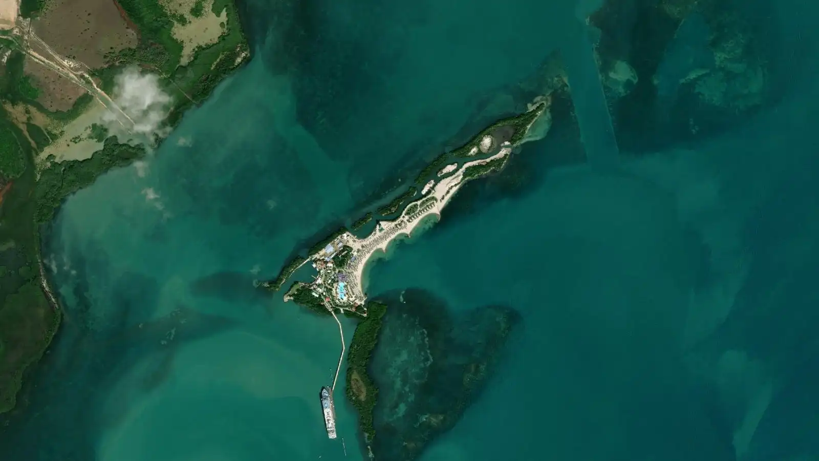
Header image: satellite view of Harvest Caye and its cruise pier. Imagery © Esri, Maxar, Earthstar Geographics.
Harvest Caye, in one paragraph
Harvest Caye is a private island owned by Norwegian Cruise Line, a few kilometres off the coast of southern Belize. Ships dock at its own pier, and everything on the island, from the beach to the pool and the zipline, is run for cruise passengers. Norwegian, Oceania and Regent Seven Seas ships call here, all from the same family of cruise lines.
What to do on the island, and beyond it
On the island, the day is a beach day: the long beach, the lagoon, the pool area and the activities sold on site. Beyond it, everything is an organized excursion:
| excursion | from the pier (straight line) | what it is |
|---|---|---|
| Placencia village | about 6 km | a beach village on a long peninsula, the closest real town |
| Silk Cayes | about 14 km | small sandy cayes on the reef, snorkeling |
| Monkey River | about 15 km | river boat through the mangrove, howler monkeys |
| Laughing Bird Caye | about 23 km | a national park caye on the reef, snorkeling |
| Cockscomb Basin | about 43 km | the jaguar reserve, jungle trails and waterfalls |
| Nim Li Punit | about 48 km | Maya ruins in the southern hills |
Same ship, next stop: Roatán
This is the strongest link of all the ports on this site. We read the itinerary of every cruise that calls at Harvest Caye: 104 of 113 also stop at Roatán, almost always on the same Western Caribbean loop.
| cruises that also call at Roatán | share | |
|---|---|---|
| Harvest Caye | 104 of 113 | 92% |
Source: Roatan Québécois itinerary survey of all published cruises calling at Harvest Caye, read cruise by cruise, 2026-10-10.
After a day inside a private resort, Roatán is the opposite: a real island, villages, the reef a few fins from the beach. The Roatán cruise ship schedule tells you which of its two terminals your ship uses. That is where I live, and where I meet my guests: small private groups, back at the ship with margin.
Cruise ship calendar: Harvest Caye
Every scheduled call, month by month, ship by ship, and which berth it pulls into. 98 calls from today through December 2028, read from the same schedule as the rest of this page.
Dates and times come from published cruise itineraries and can change on the day. Harvest Caye is Norwegian Cruise Line's private island: ships dock at its own pier.
Harvest Caye and the excursions from the island
Harvest Caye
Harvest Caye cruise pier 16.47095, -88.40578 · Harvest Caye beach & lagoon 16.48236, -88.39835 · Placencia village 16.51561, -88.36718 · Cockscomb Basin Wildlife Sanctuary 16.68795, -88.74331 · Mayflower Bocawina 16.93072, -88.40711 · Monkey River 16.36336, -88.48533 · Laughing Bird Caye 16.44375, -88.19639 · Nim Li Punit 16.32088, -88.82334 · Silk Cayes 16.51723, -88.28243 · Lubaantun 16.28124, -88.95899
The map loads only if you ask for it.
Harvest Caye cruise pier 16.47095, -88.40578 · Harvest Caye beach & lagoon 16.48236, -88.39835 · Placencia village 16.51561, -88.36718 · Cockscomb Basin Wildlife Sanctuary 16.68795, -88.74331 · Mayflower Bocawina 16.93072, -88.40711 · Monkey River 16.36336, -88.48533 · Laughing Bird Caye 16.44375, -88.19639 · Nim Li Punit 16.32088, -88.82334 · Silk Cayes 16.51723, -88.28243 · Lubaantun 16.28124, -88.95899 · OpenStreetMap relation/14531286 (Harvest Caye) ; quai lu sur l'imagerie Esri Satellite imagery: Esri,
Maxar, Earthstar Geographics. Base map and place names: OpenStreetMap, ODbL.
Things to do in Harvest Caye from the cruise port
The 9 things cruisers do most, ranked by what people actually search for (Google search volume), with the distance from the nearest pier. One is within walking distance, the rest is a taxi ride or an organized day trip. The map just above places each one.
| # | Activity | Type | Nearest pier | Distance | How to get there |
|---|---|---|---|---|---|
| 1 | Placencia village | Town & culture | Harvest Caye cruise pier | 6.4 km | taxi |
| 2 | Harvest Caye beach & lagoon | Beaches & beach clubs | Harvest Caye cruise pier | 1.5 km | walk |
| 3 | Cockscomb Basin Wildlife Sanctuary | Reef & nature | Harvest Caye cruise pier | 43 km | taxi |
| 4 | Mayflower Bocawina | Reef & nature | Harvest Caye cruise pier | 51 km | taxi |
| 5 | Monkey River | Reef & nature | Harvest Caye cruise pier | 15 km | taxi |
| 6 | Laughing Bird Caye | Beaches & beach clubs | Harvest Caye cruise pier | 23 km | taxi |
| 7 | Nim Li Punit | Maya ruins | Harvest Caye cruise pier | 48 km | taxi |
| 8 | Silk Cayes | Beaches & beach clubs | Harvest Caye cruise pier | 14 km | taxi |
| 9 | Lubaantun | Maya ruins | Harvest Caye cruise pier | 63 km | taxi |
Straight-line distance from the pier, to help you choose between walking and a taxi: the road is longer. Always keep a margin on your all-aboard time.
Frequently asked questions
Is Harvest Caye a real port in Belize?
What is included at Harvest Caye?
Can I leave Harvest Caye on my own?
Where does the Harvest Caye cruise ship schedule on this page come from?
My ship stops at Harvest Caye and at Roatán. Is the day the same?
Only one day in Roatán? Make it unforgettable
Give me your ship's name and your port-call hours: I build the day around your schedule and get you back well before all-aboard. In English, French or Spanish, in a small group, with zero pressure to buy.
⏰ Guaranteed return to your ship, or a full refund if your ship can't dock.