The Roatán dive site map, reef by reef
This page carries three things, and they do not say the same thing. First the marine park's own map, right below: the most complete one there is, every mooring buoy by name. Then the reef sectors whose seabed has been measured from satellite, coral and seagrass, so you know what works with a mask. Last my drone footage, one reef at a time, seen from above. I am still filming, so that one keeps growing.
The interactive map of Roatán's dive and snorkel sites
This is the marine park's own map, and it is the most complete one there is: every mooring buoy, by name, from the walls off West End out to the seamounts. What I film with the drone is a part of it, and you will find that further down.
Snorkel or dive: which sites work from the surface
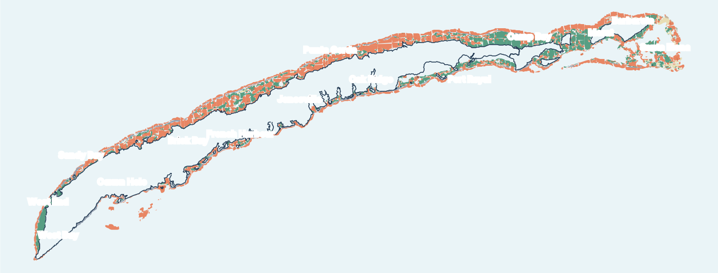
The marine park's own mooring database separates the two, and the gap is wider than people expect: the great majority of its markers are dive moorings, and only a handful are snorkel moorings. That matters if you are coming off a ship for the day with no certification. The reefs that work from the surface are the ones where the shelf stays shallow close to shore, and that is what this map shows. The best spots to reach from the beach are in our full Roatán snorkeling guide.
| Sector | Living coral | Seagrass |
|---|---|---|
| West End | 32 % | 56 % |
| West Bay | 33 % | 40 % |
| Sandy Bay | 46 % | — |
| Coxen Hole | 73 % | — |
| French Harbour | 51 % | 29 % |
| Punta Gorda | 75 % | — |
| Sector | Living coral | Seagrass |
|---|---|---|
| Oak Ridge | 54 % | — |
| Port Royal | 40 % | 37 % |
| Morat | 52 % | 45 % |
| Barbareta | 56 % | — |
| Santa Elena | 37 % | 40 % |
Every point is a reef sector with a measured seabed: the share of living coral comes from satellite survey, not from an estimate. Punta Gorda holds the island record at 75 % coral, West End is the most grassy at 56 % seagrass, and Morat, out past Camp Bay, carries one of the most balanced coral to seagrass ratios of the whole archipelago. Coral close to shore is what you came to see with a mask on; seagrass is what you swim over to reach it.
See the reef before you dive it
Every reef I fly ends up in one playlist, Drone Dive Map of Roatán. You can watch a site from the air before you decide to get in the water, which is the whole reason I started flying them.
Roatan scuba diving, seen from the air
Roatan snorkeling, reef by reef
Watch the whole playlist on YouTube · 8 more reefs filmed, not yet on the feed
What the marine park asks of you
The reef is a protected area and the rules are not decoration: no gloves, no touching, no standing on coral, and use the moorings rather than dropping an anchor. The park maintains the mooring buoys you will tie to, and it publishes its own site map, which covers far more than I have filmed.
Getting to the reef
Several of these reefs are a shore entry and cost you nothing but a walk. Others need a boat, and a few are a full day out. If you are on a ship for the day, or you want someone who knows which reef is calm on the morning you are here, that is what I do.